Trip to Kagoshima (3)
July 4, 2024
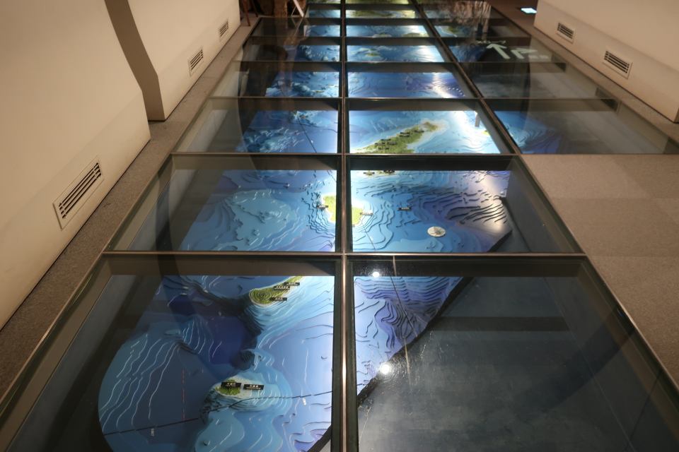
One of impressive things during my trip to Kagoshima was a relief map of Kagoshima Prefecture exhibited at the entrance of Kagoshima Prefectural Museum of Culture named Reimeikan. As a matter of course, Kagoshima Prefecture includes the northern part of Nansei Islands such as Amami Oshima or Tanegashima. The map showed me the fact the Kagoshima Prefecture occupies a very large area intelligibly.
It must be interesting to analyze the relation between geographical or topographical environment of one place and the local history and culture.
The local specialties of Kagoshima are Sakurajima radish, sweet potatoes, and so on. And those of Wakayama are satsuma mandarins, umeboshi (a type of pickled plum), and so on. Both prefectures are not endowed with a natural setting suitable for wet-rice cultivation, aren't they?